 Download PDF
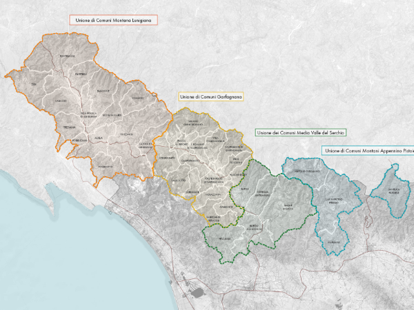
Italian “Inner Areas,” characterized by weak and dispersed mobility demand, suffer from the progressive inefficiency of conventional Local Public Transport (LPT) services within these territorial contexts. The territorial scope of the project is located in the Tuscan-Emilian Apennines, in a setting where complex topography and progressive demographic aging render standard market-based LPT solutions ineffective.
The “Smart Mobility” project, funded under the National Strategy for Inner Areas (SNAI) through the Program Agreement for “Garfagnana – Lunigiana – Media Valle del Serchio – Appennino Pistoiese,” implements the SMIC model managed by a supra-municipal Mobility Office. The intervention integrates vehicle procurement—granted under usufruct to the Third Sector for the “Community Service” (targeting vulnerable users)—with the PORT.A.M.I. digital platform to coordinate flexible sharing services, ensuring the right to mobility in areas facing an LPT market crisis.
TPS has monitored and supported the mobility management strategy project which, through an operational and managerial co-design process with the Unions of Municipalities, stakeholders, and local communities, has overcome the limitations of an approach based exclusively on volunteering and population self-organization.
The project’s objective is to establish a Mobility Management system for the entire Inner Area that goes beyond the technical planning of infrastructure and services, integrating social co-design into the process from a resilient perspective. This makes communities autonomous in managing mobility as an effective service and decouples them from the mere procurement mechanism of transport vehicles.
In areas where “Standard” Local Public Transport fails, mobility must become “community-based,” integrating institutional resources, the Third Sector, and citizens.
The feasibility analysis highlighted two key issues concerning the “Community Service”: operational unsustainability, due to low participation by Third Sector entities, and regulatory constraints that prevent the extension of the service to tourists and general users to avoid market conflicts with scheduled LPT, Taxis, and rental cars with driver (NCC).
The methodology adopted to resolve these two issues takes the form of an action-research process, which evolved the initial theoretical planning into an operational redesign coordinated by the Mobility Office based on new geographical technical insights and the widespread use of co-design.
The need to overcome the two challenges of the Community Service required a radical overhaul of the service architecture through a co-design approach that involved administrators, technicians, and local stakeholders. The Mobility Office, composed of the Area Mobility Manager as coordinator and the technical representatives of the Unions of Municipalities, acted as a steering committee for project remodeling. Following a three-month training program, local Mobility Managers initiated a structured dialogue with the Third Sector and private operators to define a sustainable “social taxi” model.
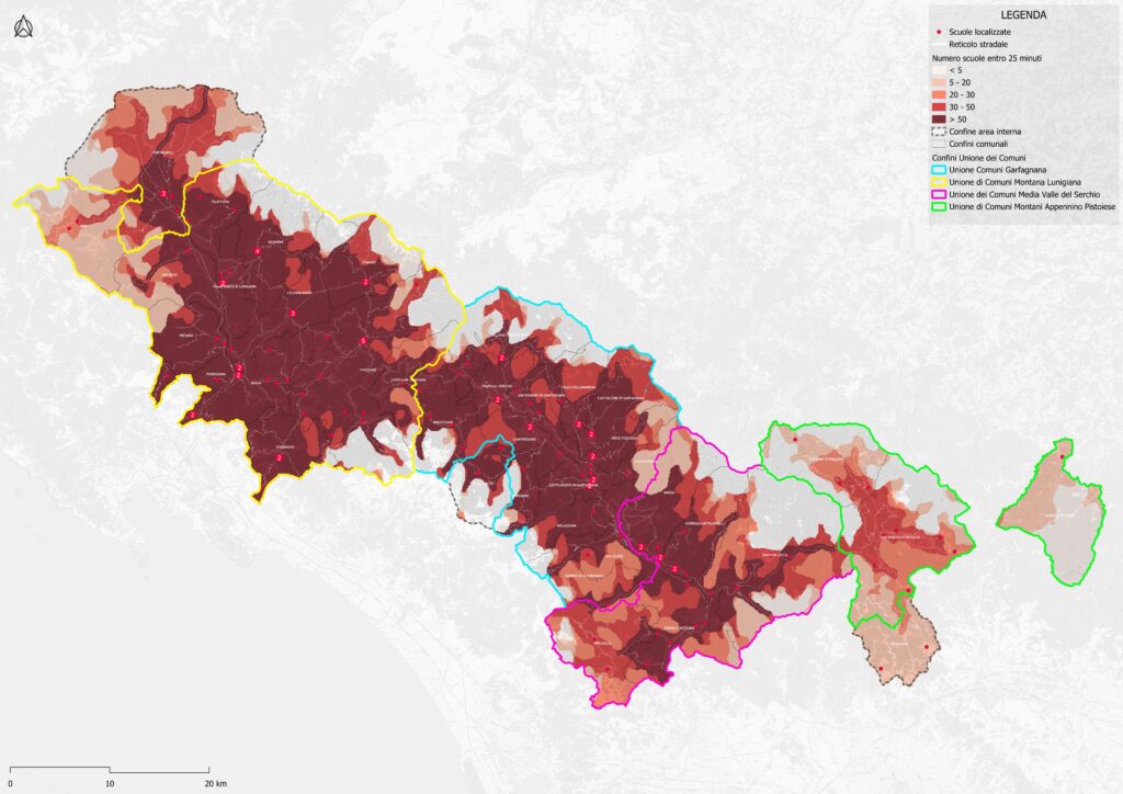
Contemporaneously, a geographical database (GIS) was implemented to spatialize the various types of marginality, cross-referencing supra-local Points of Interest (POIs) with the actual accessibility conditions of hamlets and scattered dwellings. The definition of the new service model and GIS mapping represent the operational output addressing the identified critical issues.
Finally, stemming from the co-design path, a carpooling platform complementary to the Community Service provided by Third Sector operators was conceived, targeting all inhabitants of the inner area and city users. The carpooling service allows validated users to share rides (“Depart Now” or “Planned Ride”), promoting social mobility and local connectivity. Although distinct from the social taxi for the most vulnerable, the carpooling system itself acts as a community service, enabling residents to help each other with travel, reducing isolation, and creating a support network.
The synergy between the community service and carpooling achieved by the Mobility Office based on the outcomes of co-design and the geographical database aims to largely overcome the two operational issues highlighted by the feasibility study.